Walking in TOKYO Suburbs 01 "To Mt. Arahata Fuji"
We describe the weather of early spring as "Three cold and four warm days." In Kanto District, warm days are increasing. My turtle is awakening from hibernation. So am I. I could hardly keep staying indoors any more and jumped out of home for walking. My specialty is traveling neighborhood for now! This time my destination was "Mt. Arahata Fuji," which I've been willing to visit for a long time. It 's been one of the "untrodden spots" for me. Japanese people have special adoration and piety for Mt. Fuji." Fuji" means "one and only" and Mr. Fuji has been admired as "Ghostly Mountain." It was regrettably reported in 2010 that there is no more any spot where we can have a glance at Mt. Fuji from JR Yamanote Line. People in flat and fuge Kanto Plain long for mountains. Certainly we can have a look at views of mountains after taking a trip by train for one hour from the central part of Tokyo, but for most of those who are bound by daily chores can hardly attain even that. Occasionally, however, weather permitting, Mt. Fuji can be seen. The last people seemingly having no interest in mountains at all exchange words saying, "Did you see Mt. Fuji this morning?" and "Of course I did. How majestic!" A student from Yamanashi Prefecture insisted that Mt. Fuji belongs to Yamanashi,, not Shizuoka as people believe. Therefore, we can say most of Japanese people have "faith in Mt. Fuji" and consequently they built replicas of the mountain in their own places. It was so difficult to make the copy of its shape itself that they had to be contented with building the highest view spots in their areas. If they were fortunate enough, they ccould get the view of real Mt. Fuji in a distance from the top. At the foot of the mountain, there is a shrine to celerbrate it. (Or I should say a replica of Mt. Fuji was "constructed" within the estate of the shrine as a symbol of piety.) Today, I started for Mt. Arahata Fuji in Saitama Prefecture. According to a guide book, "Mt. Arahata Fuji was built by people's hands from 1884 to 1899 in order to unify their minds. It is still preserved by people in the area. The altitude of the mountain is 119 meters, and you can find stone marks which were placed there when the mountain was built. I like to climb up to a spots at a higher altitude whether they are mountains or observatories in buildings. Wow, the view from Mr. Arahata Fuji was fabulous. You can get a 360-degree view around you at the top of the mountain. You can see boundary areas of Tokyo-Saitama and (if weather permits) Chichibu Mountains with real Mt. Fuji beyond them. It gives us a remarkable landscape indeed! The dream that people at the end of 19th century is inherited to people in 21 century. (As you see in the photos, Kanto Area is really flat basically. That's why I'm so eager for the views of mountains and ocean.!) I'll upload my walking diary occasionally. For contact, mail to KK |
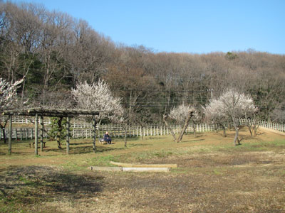
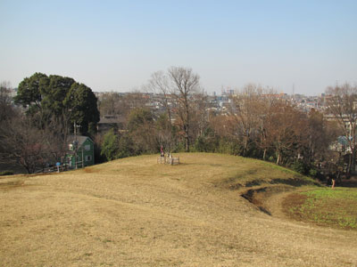
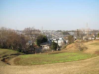
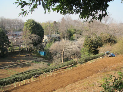
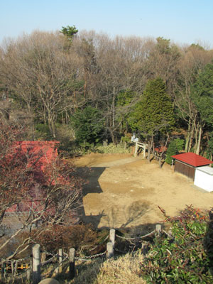
Hachikoku-yama Hills viewed from Kitayama Park
|
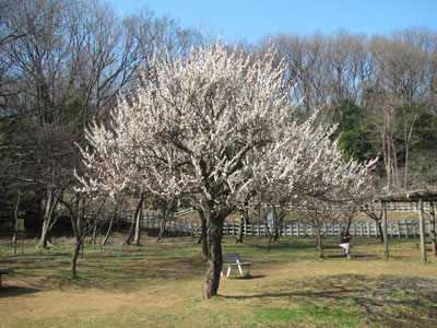
Japanese Plum trees are now intheir full bloom.
|
A man was enjoying himself under a plum tree.
|
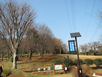
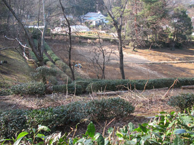
A play ground at the foot of the hill.
|
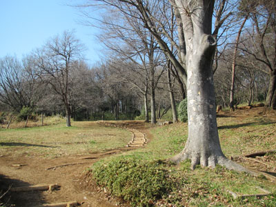
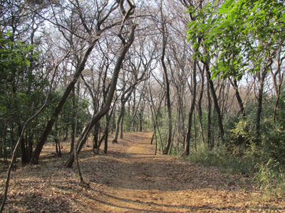
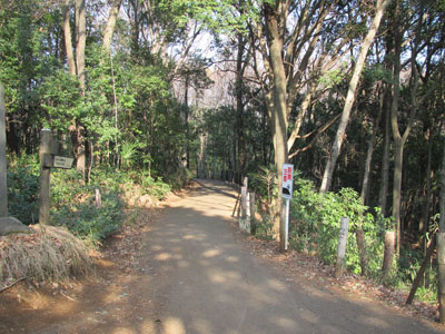
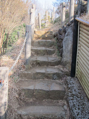
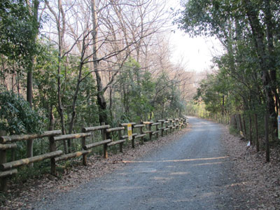
A path leading to a ridge lane.
|
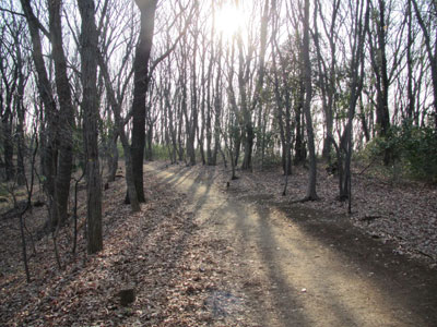
Sunshine is falling over the ridge lane.
|
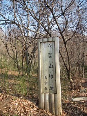
A wooden sing-board of "Hachikoku-yama Hills"
|
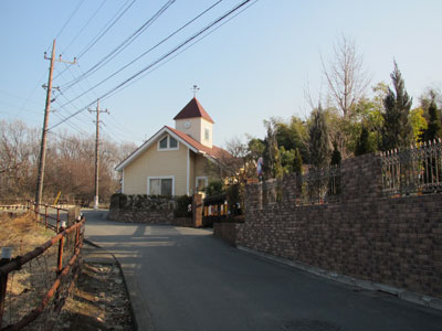
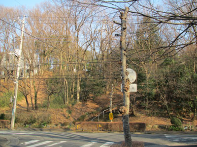
A step out of the hills, there is a town of concrete.
|
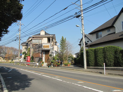
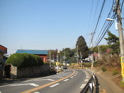
I followed a car-streaming rode for a while.
|
The road wa svery quiet when no cars were going.
|
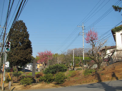
Trees were colord in early spring pink. |
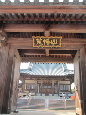
A plate reading "Mt. Arahata Fuji" was at the gate of Kouzouji Temple.
|
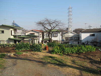
While climbing up a residential street, I found vegetable fields here and there.
|
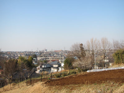
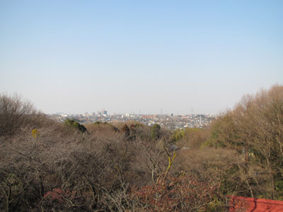
A wide view opens on the western side.
|
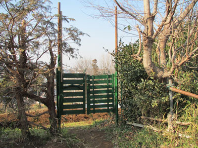
Beyond the green painted doors, you'll see...
|
A crowded city view with houses and buildings.
|
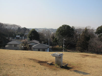
This is "Do-Re-Mi Hill" of Tokorozawa City.
|
A city view beyond the Hill.
|
A drinking fountain of "Do-Re-Mi Hill"
|
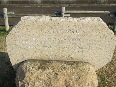
The stone engraved with the words describing how the hill was donated by a citizen to City of Tokorozawa in 2000.
|
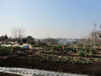
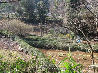
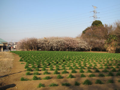
Well maintained farm on the way to Mt. Arahata Fuji.
|
A farmer was working in the field.
|
A farm in early spring colors.
|
A farm cultivated on the slope.
|
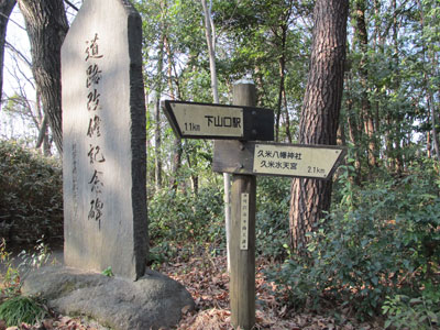
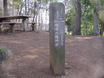
Sign-boards at the top of the hill under trees.
|
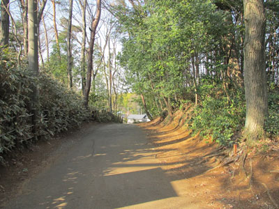
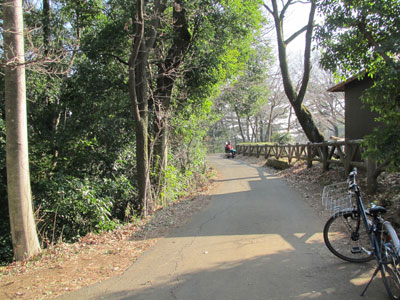
I walked along such a lane as this to Asama Shrine.
|
I came out of this lane in woods.
|
A lane beside the shrine.
|
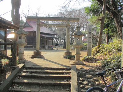
Asama Shrine at the foot of Mt. Arahata Fuji.
|
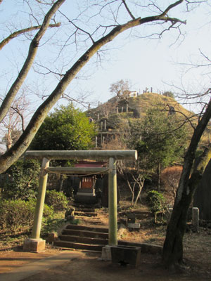
This is it! Mt. Arahata Fuji.
|
A view of the shrine from the mountain steps.
|
Mountain steps.
|
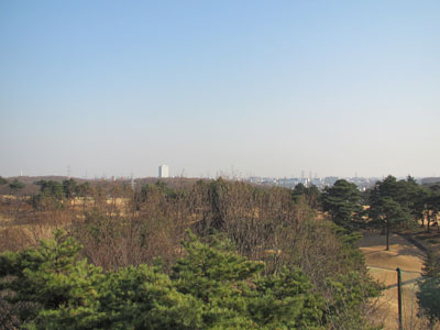
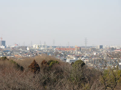
A south eastern view. (You can see a tall building in the north of Higashimurayama Station.)
|
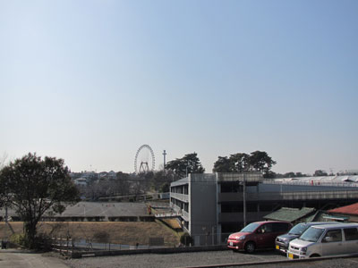
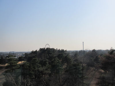
A south western view. (You can see a Ferris wheel of Seibu Amusument Park.)
|
A north view. (They say you can see as far as Kotesashi City.)
|
A north view zoomed.
|
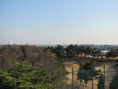
Seibu Golf Course below Mt. Arahata Fuji in south.
|
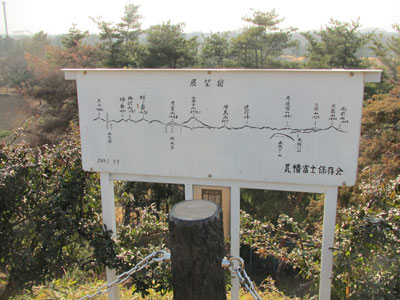
Looking west. From left you read, Mt. Ooyama, Tou-no-take, Mt. Tanzawa, Hiru-ga-take, Mt. Oomuro, Mt. Fuji, Mt. Jinba, Tsuji-no-touge, Mt. O- -zuri, Mt. Mitsumine, Mt. Ohtake, Mt. Gozen.
|
A field of plum trees and wheat on my way down from a hill up to another.
|
Tokorozawa 5th Kindergarten and its nature obsertory park.
|
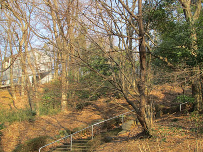
A path leading to Hato-mine Park.
|
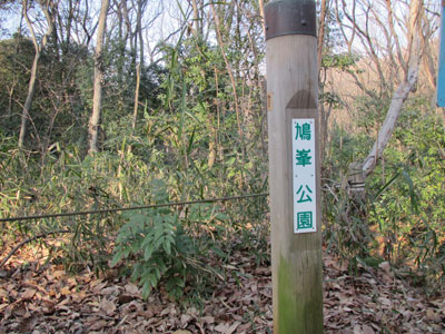
A sign-board of Hato-mine Park.
|
This area is also "The Totoro 2nd Zone," an area preserved by the National Trust.
|
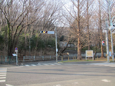
A signal under Kume Suitenguu-Shrine.
|
An entrance into Hachikoku-yama Hills is in a residential area.
|
You can climb the steps up to the ridge lane.
|
The sun is setting beyond the ridge lane.
|
Toda's route: Home, in the westend of Higashimurayama city, Tokyo - (by bicycle) - Kitayama Park - (on foot) - walking along ridge lanes in Hachikokuyama Hills - Mtsugaoka West - Kougen-ji Temple - Arahata Primary School - " Do-Re-Mi Hill" - Asama Temple - Mt. Arahata fuji - Tokorozawa 5th Kindargarten and its Observatory Park - A Stone Monument for Animal's Soul - Hatomine Park - Hachikokuyama Hills - Kitayama Park - (by bicycle) - Home Total time for walking and cycling: 3 hours and 30 minutes (3 hours is enough for walking fro Kitayama Park to Kitayama Park.) Reference: Home of Totoro, Walking and observing in Sayama Hills (Miki Shobou 2008) -in Japanese with maps and photos |